The Corner Where The Canal Meets The Low-rise Skyline
You come out of Tiong Bahru MRT station at Exit B, and the first thing you notice is not a tower but a gap. Across Tiong Bahru Road the buildings drop to...
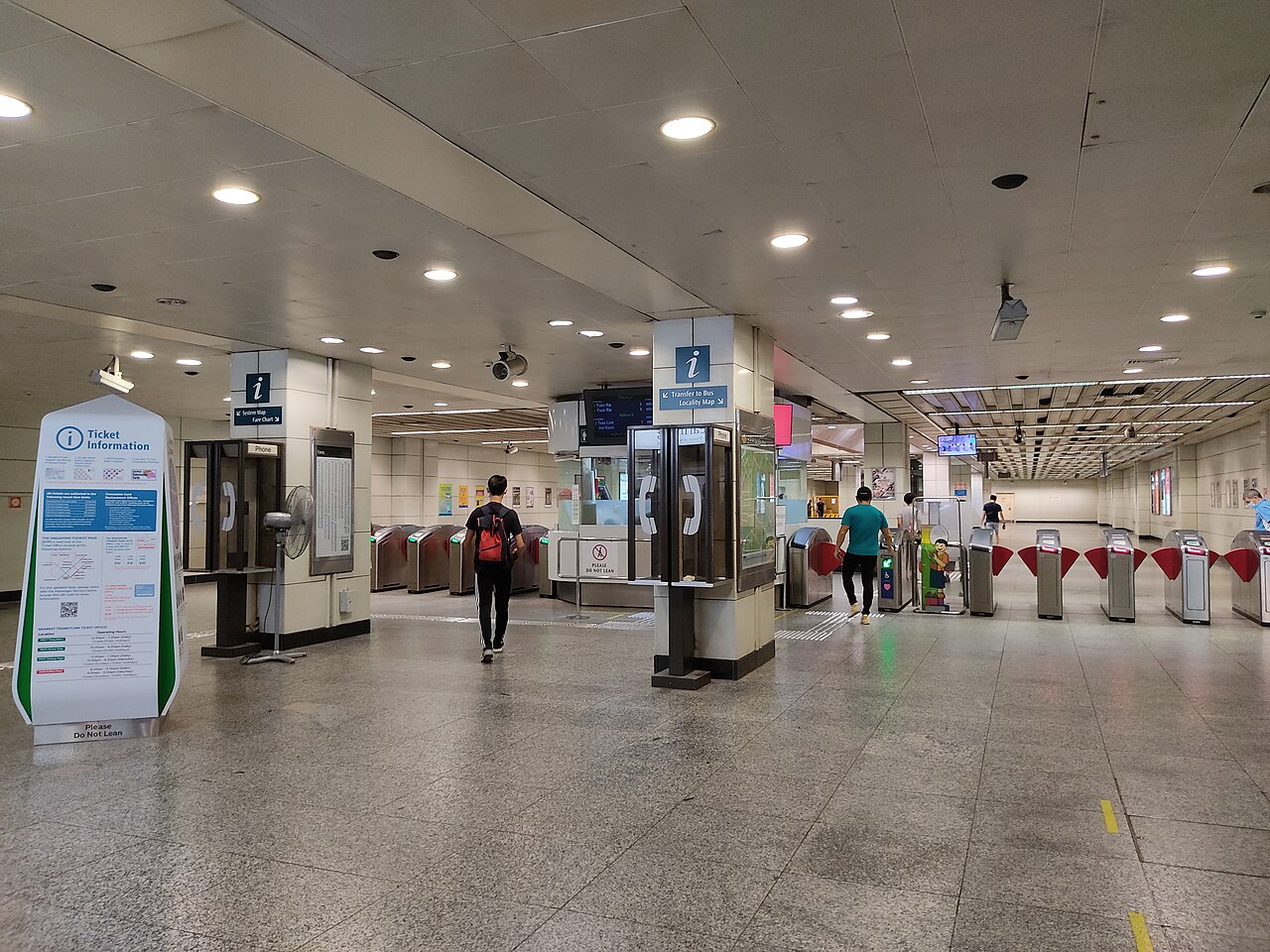
Photo: ZKang123 / Wikimedia Commons, CC BY-SA 4.0 (source)
You come out of Tiong Bahru MRT station at Exit B, and the first thing you notice is not a tower but a gap. Across Tiong Bahru Road the buildings drop to four storeys, and a canal path runs beside them with palms leaning over the railing. The air smells of wet concrete and cooked sugar from a you tiao stall you cannot yet see. At 9:14 a.m. a man in flip-flops is already walking a small dog along the water, and that is the direction you will take.
The Tiong Bahru Slow Walk is a self-guided route of about 3.5 kilometres that loops through one of Singapore's oldest public-housing estates. It takes roughly two hours if you pause at the market, the park and a coffee shop, though you can stretch it to a morning easily. The Singapore Tourism Board includes it in its "Slow Walks" series, but on the ground it feels less like an itinerary and more like a neighbourhood that has never been in a hurry.
The estate was developed by the Singapore Improvement Trust in the 1930s, and its pre-war blocks - built between 1936 and 1941 - are still standing along streets like Guan Chuan and Eng Hoon. You are about to walk through a piece of housing history that predates the Housing and Development Board, through a place where Streamline Moderne curves meet wet-market noise and a playground shaped like a spaceship.
This article traces a route from the MRT station to the market, the park, the shophouse streets and the community centre, then back to the canal path. Every turn is named, every stop is something you will actually pass, and nothing here is invented. The walk begins where you are standing now: on the footpath beside the canal, heading south.
The Canal Path That Sets The Pace
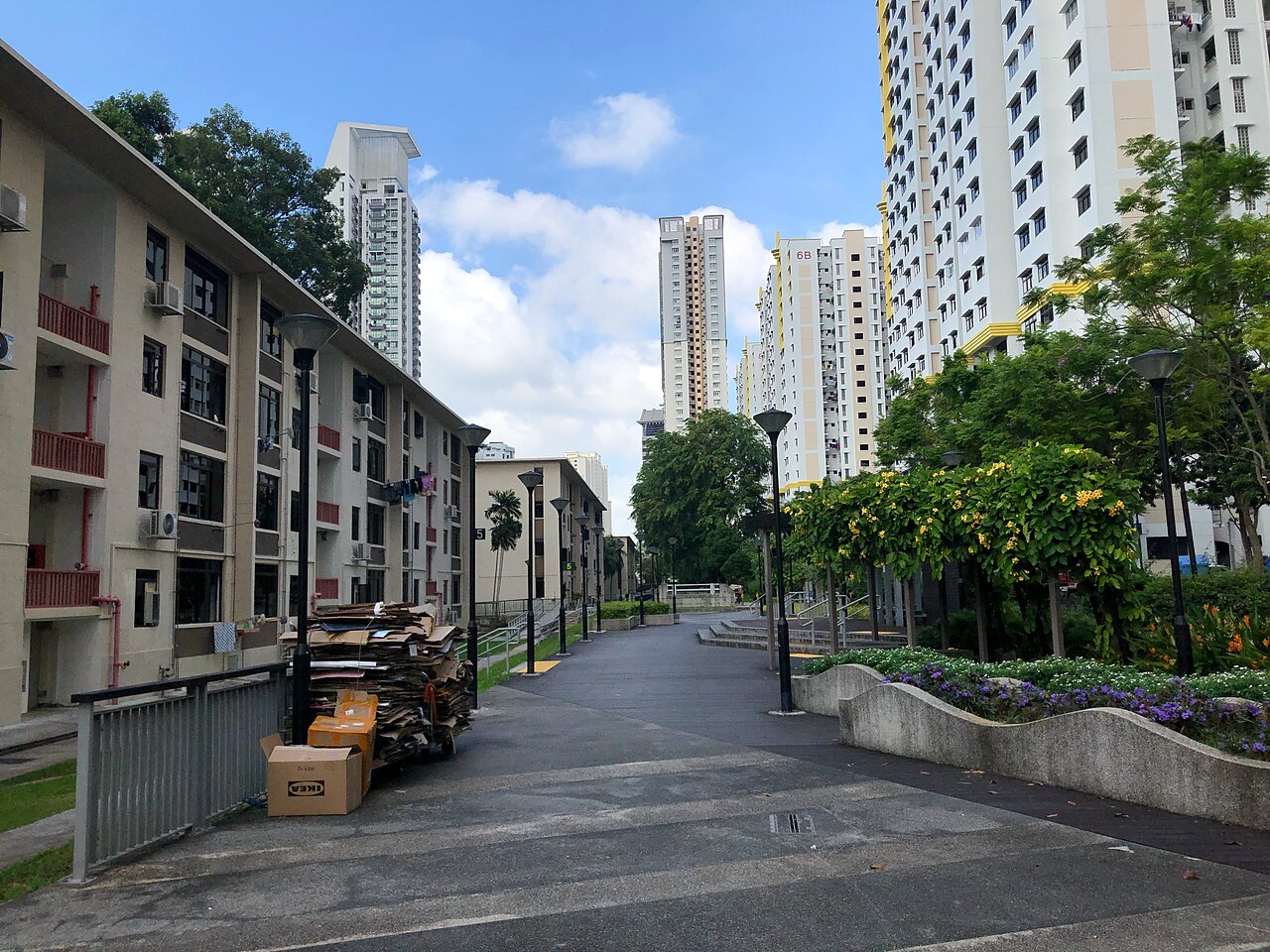
Photo: Wzhkevin / Wikimedia Commons, CC BY-SA 4.0 (source)
Cross Tiong Bahru Road at the lights and step onto the footpath that runs between the road and the canal. The path is paved and wide enough for two people to walk abreast, with a low metal railing on the water side and a row of palms on the other. The canal itself is concrete-lined and shallow, carrying rainwater south toward the Singapore River catchment. On a weekday morning the loudest sound is the hum of traffic from the road, but the path is set just low enough that you feel separated from it.
The route runs parallel to Tiong Bahru Road for about 300 metres before it bends left toward Boon Tiong Road. According to the National Parks Board, the landscaping along this stretch connects to the park connector network, though the path here is not a dedicated park connector. It is simply a well-used shortcut by residents walking to the market. You will pass aunties with trolley bags and young parents pushing strollers, and by 9:30 a.m. the benches are often occupied by older men reading the Chinese papers.
At the bend, look up. The blocks to your right are part of the Singapore Improvement Trust flats built in the late 1930s. They are four storeys high with flat roofs, horizontal banding and rounded corners - the first hint of the Streamline Moderne vocabulary that defines the estate. The Docomomo Singapore documentation of Streamline Moderne architecture in Singapore notes the style's nautical references, and here the porthole windows and curved balconies make the buildings read almost like ships docked beside the canal.
Follow the path as it turns left and crosses a small footbridge over the canal. The bridge leads directly to the back of a row of shophouses on Seng Poh Road. The shift is abrupt: one minute you are on a quiet waterside path, the next you are facing the rear entrances of kopitiams, their kitchens exhaling steam and the clatter of woks. The smell of frying shallots hits you before you see the street.
Walk through the gap between the shophouses and emerge on Seng Poh Road. You are now at the southern edge of the estate, and the market is one block to your left. The canal path has done its job: it has slowed you down, given you the low-rise scale of the neighbourhood, and delivered you to the place where Tiong Bahru does its daily shopping.
Tiong Bahru Market, 1951 And Still Steaming
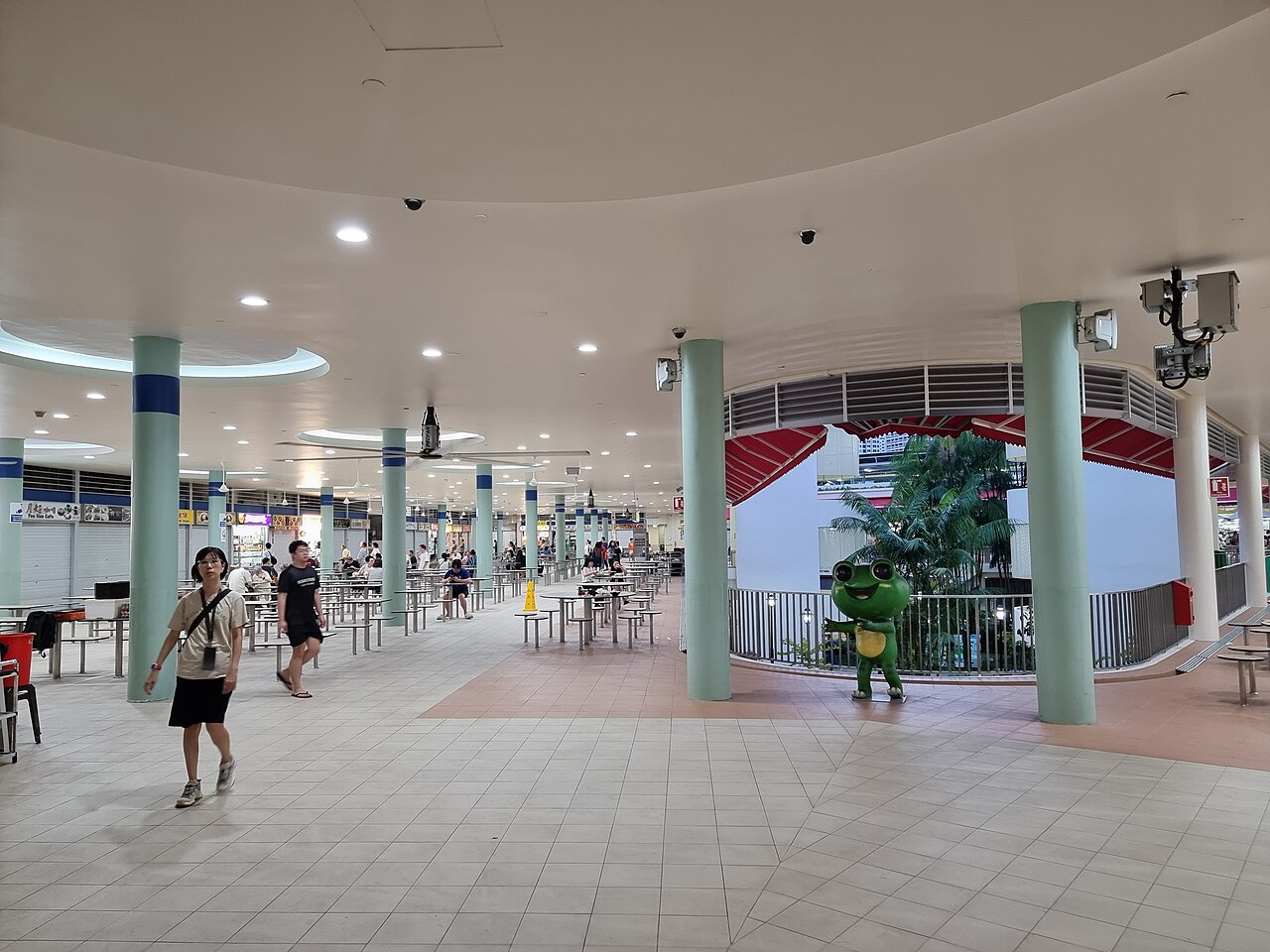
Photo: Kbseah / Wikimedia Commons, CC BY-SA 4.0 (source)
Turn left on Seng Poh Road and walk half a block to the pedestrian crossing. The Tiong Bahru Market and Food Centre rises on your right, a two-storey structure with a curved roof and wide, open sides. The original market opened here in 1951, according to the National Heritage Board's entry on the building. It was rebuilt in 2006 with a design by Surbana that retained the open-air feel while adding a wet market on the ground floor and a hawker centre above.
Enter through the ground-floor wet market first. The stalls are arranged in narrow aisles, the concrete floors perpetually damp from hosing. Fishmongers lay out rows of pomfret and red snapper on crushed ice, while vegetable sellers stack bok choy and bitter gourd in neat pyramids. The noise is a layered thing: the slap of a cleaver on a chopping board, the call of a stallholder announcing a price, the hiss of a hose washing down a tray. By 10 a.m. the morning rush is easing, but the market still feels fully alive.
Take the escalator or the stairs to the second floor. The hawker centre holds more than 80 stalls, and the layout is a grid of numbered aisles under high ceilings and ceiling fans. The National Heritage Board notes that the centre is known for its chwee kueh - steamed rice cakes topped with salted radish - and for the lor mee stalls that draw queues before noon. Stall 02-05, Jian Bo Shui Kueh, is one of the names you will hear from regulars. A plate of chwee kueh costs a few dollars, and the radish topping is savoury and slightly crisp at the edges.
Find a table near the open side facing Seng Poh Road. From here you can watch the street below: the buses stopping at the shelter, the bicycles weaving between cars, the constant stream of shoppers with plastic bags. The market is not a tourist stop so much as a working food centre that happens to sit inside a heritage trail. Eat your chwee kueh, drink a kopi from the stall at the far end, and then head back down to the street.
Exit the market the way you came in and turn right on Seng Poh Road. Walk one block to the junction with Tiong Poh Road. The next stop is the park, but the short walk there takes you past some of the estate's most distinctive shophouses.
Streamline Moderne On Seng Poh And Tiong Poh
The junction of Seng Poh Road and Tiong Poh Road is a good place to stop and look at the buildings. The shophouses here are two- and three-storey structures with curved façades, flat roofs and horizontal grooves running across the upper floors. The Docomomo Singapore documentation describes Streamline Moderne as an architectural style that borrowed from the aerodynamic forms of ships and aeroplanes, and the Tiong Bahru blocks are among the clearest examples in Singapore.
On Tiong Poh Road, look at the corner shophouse with the rounded balcony. The balcony is a continuous curve of concrete, painted white, with a metal railing that follows the same arc. Above it, a porthole window with a circular frame and radial mullions looks out onto the street. These portholes are a signature of the estate. They appear on many of the pre-war blocks, set into stairwells and sometimes into the façades themselves, and they give the buildings a quiet, maritime character.
Walk north along Tiong Poh Road for about 150 metres. The shophouses on your left were built by the Singapore Improvement Trust between 1936 and 1941, part of a programme that produced some 20,000 housing units before the Trust was dissolved and replaced by the Housing and Development Board in 1960. The Trust's work in Tiong Bahru was among its most architecturally ambitious, and the Urban Redevelopment Authority's heritage trail notes that the estate was conceived as a model of modern urban living.
At number 58 Tiong Poh Road, the shophouse has been converted into a café. The ground-floor shopfront is glazed, but the upper storeys retain their original proportions. The contrast is typical of Tiong Bahru today: a specialty-coffee bar inside a 1930s frame, the old and the new sitting side by side without much fuss. You can stop for a flat white here, or keep walking to the park.
Continue north to the end of Tiong Poh Road and turn right onto Guan Chuan Street. The walk-up apartments on this street are among the most photographed in the estate. Their façades are symmetrical, with central stairwells marked by vertical fins and more porthole windows. The Docomomo Singapore documentation points out that the fins and horizontal banding create a sense of motion, as if the buildings were gliding forward. Stand in the middle of the street and look up: the effect is quiet but unmistakable.
Guan Chuan Street dead-ends at a small lane that leads to Tiong Bahru Park. Follow the lane past a row of back gates and washing lines, and enter the park through the side gate near the playground.
A Spaceship In A Two-hectare Park
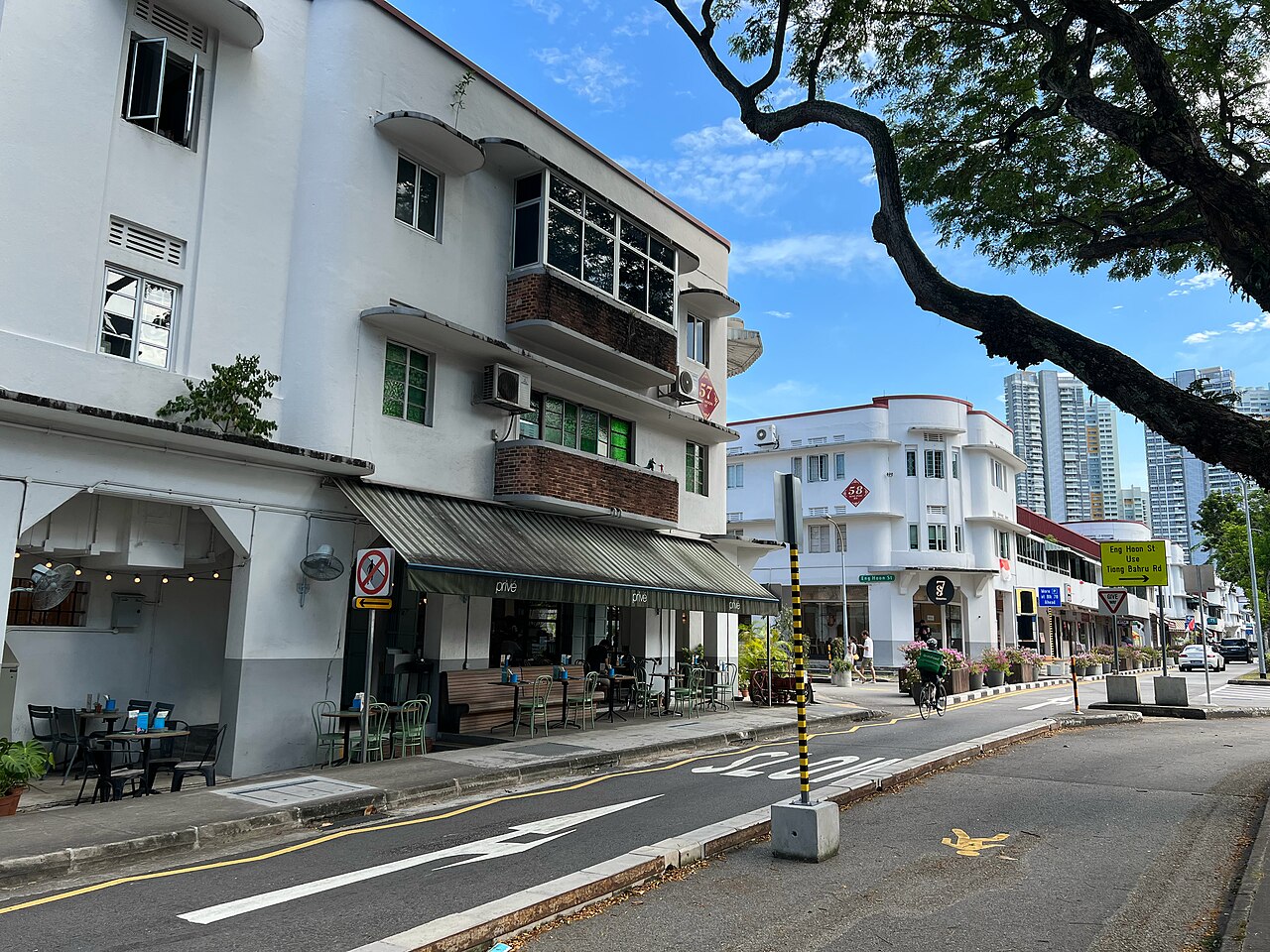
Photo: Wzhkevin / Wikimedia Commons, CC BY-SA 4.0 (source)
Tiong Bahru Park opened in 1967, according to the National Parks Board, and it covers about two hectares of gently sloping ground. It is not a grand green lung like the Botanic Gardens. It is a neighbourhood park, the kind where residents walk their dogs before work and children climb on a playground that looks like something from a 1970s science-fiction comic.
The playground is the park's most talked-about feature. It is shaped like a spaceship, a blue-and-white structure with a central dome, porthole windows of its own, and metal slides curving down from the sides. The design is a deliberate echo of the estate's Streamline Moderne architecture, though the playground itself dates from a later renovation. Children scramble up the dome while parents sit on the benches under the rain trees, and the whole scene has the unhurried feel of a Sunday morning even on a Tuesday.
Walk the perimeter path that circles the park. It is about 400 metres around, shaded for much of its length by mature angsana and rain trees. The path is popular with joggers in the early morning, but by mid-morning it is quiet enough that you hear the mynahs calling from the branches. There is a small exercise corner with pull-up bars and a sit-up bench, and a pavilion where a tai chi group sometimes gathers.
The park connects directly to the estate's street grid at several points. Exit through the main gate on Tiong Bahru Road, cross the road at the lights, and you are back in the shophouse streets. But before you leave, walk to the northern edge of the park and look back at the estate through the trees. The low-rise blocks rise just above the canopy, their white façades and curved corners visible between the leaves. It is a view that has not changed much since the 1960s.
From the main gate, cross Tiong Bahru Road and turn left. Walk one block to the junction with Eng Hoon Street. The next section of the walk takes you through the heart of the pre-war estate, past the community centre and toward the mural that marks the eastern edge of the route.
Eng Hoon Street And The Pre-war Walk-ups
Eng Hoon Street runs east-west through the centre of the estate, and it is lined on both sides with the same Singapore Improvement Trust walk-up blocks you saw on Guan Chuan Street. The street is narrow by modern Singapore standards, just wide enough for one lane of traffic in each direction, and the buildings press close to the pavement. Their ground floors are painted in muted shades of cream, pale green and ochre, and many of the original metal-framed windows are still in place.
Walk east along Eng Hoon Street toward the community centre. The blocks here were built between 1936 and 1941, and the Urban Redevelopment Authority's heritage trail describes them as some of the earliest examples of public housing in Singapore designed with architectural intent. The Singapore Improvement Trust hired architects who had trained in the Modernist tradition, and the result was a housing estate that looked like nothing else in the colony at the time.
At number 78 Eng Hoon Street, look for the vertical fin that marks the stairwell. The fin rises the full height of the block and is pierced by a series of small rectangular openings that let light and air into the staircase. These fins are functional - they shade the stairwell from the afternoon sun - but they also give the blocks a rhythmic, sculptural quality. The Docomomo Singapore documentation notes that such fins were a common feature of Streamline Moderne residential architecture in the tropics.
Halfway along the street, you reach the Tiong Bahru Community Centre. The building dates from 1950, according to the heritage trail, and it is a modest two-storey structure with a pitched roof and a covered verandah. The community centre hosts art exhibitions, craft workshops and occasional heritage talks, and its noticeboard is usually covered with flyers for yoga classes and Chinese calligraphy sessions. If the doors are open, step inside and look at whatever exhibition is on. The space is small, but it offers a window into the estate's present-day life, not just its architecture.
From the community centre, continue east to the end of Eng Hoon Street. Turn right onto Tiong Bahru Road and walk one short block to the junction with Seng Poh Road. On the wall of the building at the corner, you will find the Tiong Bahru Estate mural. The mural is a recent addition, painted as part of a community art project. It depicts scenes from the estate's history: a samsui woman carrying bricks, a row of pre-war shophouses, a market stall piled with fruit. The colours are bright, and the style is figurative. It is a popular spot for photographs, but it is also a reminder that the estate's heritage is not only architectural - it is the story of the people who built it and the generations who have lived here since.
The Loop Back Through Moh Guan Terrace
From the mural, turn left onto Seng Poh Road and walk south, retracing part of your earlier route. At the junction with Tiong Poh Road, turn right and then immediately left onto Moh Guan Terrace. This short street is one of the quietest in the estate, a cul-de-sac lined with low-rise blocks and a few small shops. A traditional Chinese medical hall sits at the corner, its wooden cabinets filled with jars of dried herbs, and the smell of ginseng drifts out onto the pavement.
Moh Guan Terrace ends at a pedestrian lane that cuts through to Guan Chuan Street. Take the lane, and you will pass the back of the blocks you walked past earlier. This is the estate seen from its service side: bamboo poles hung with laundry, potted plants on stair landings, a cat asleep on a windowsill. The lane brings you out near the junction of Guan Chuan Street and Tiong Poh Road, and from here it is a short walk back to the canal path.
Turn right onto Tiong Poh Road and walk south to the canal. The path here is the same one you started on, but coming back to it in the late morning feels different. The sun is higher, the shadows are shorter, and the benches are empty now. Walk north along the canal toward the MRT station, and you will pass the same palms, the same low railing, the same view of the estate's curved balconies across the water.
The walk ends where it began, at the foot of the MRT station. You have covered about 3.5 kilometres in roughly two hours, not counting the time you spent eating at the market or lingering in the park. The route is a loop in the loosest sense: a line out, a turn through the estate's heart, and a return along the same canal path that set the pace at the start.
The Practical Details
- Start and end point: Tiong Bahru MRT station (EW17), Exit B. The walk loops back to the same station.
- Nearest station: Tiong Bahru MRT, East-West Line.
- Walking time: About 2 hours at a gentle pace, excluding stops for food, coffee or the community centre exhibition.
- Route length: Approximately 3.5 kilometres.
- Market hours: Tiong Bahru Market and Food Centre is open daily from roughly 6 a.m. to late afternoon, though individual hawker stalls set their own hours. The wet market closes earlier, typically by 1 p.m.
- Park hours: Tiong Bahru Park is open 24 hours, but the playground lighting operates from 7 a.m. to 7 p.m.
- Approximate costs: A plate of chwee kueh at the hawker centre costs SGD 2-3. A coffee at a Tiong Poh Road café runs SGD 5-7. The walk itself is free.
- Access: The canal path and most streets are wheelchair-accessible, though some older shophouse walkways are narrow. The market has lifts to the second floor.
The Takeaway After The Walk
The thing you notice after walking Tiong Bahru is not the Streamline Moderne curves or the hawker-centre steam, though both stay with you. It is the scale. The estate sits low under the sky, its blocks no taller than the rain trees in the park, and the streets feel proportioned to a human pace rather than a car's. The canal path, the market, the playground spaceship, the back lane with its laundry poles - none of them are grand, and that is the point. This is a neighbourhood that has been lived in continuously for nearly ninety years, and the walk simply traces the shape of that life.